Mount Washington Walking Tour (Self Guided), Pittsburgh
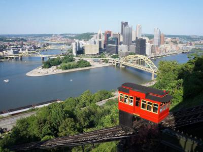
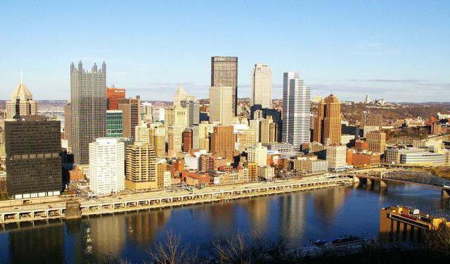
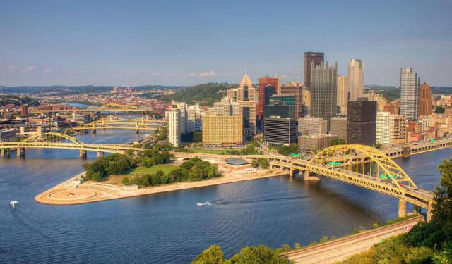
Mount Washington is a hill on the southern banks of the Monongahela River and Ohio River. Due to its elevated position, the top of the hill offers a spectacular view of Downtown Pittsburgh below. The Mount is a prime tourist attraction in the city, and many photos and drawings of the Pittsburgh skyline have originated here.
If you want to see what Pittsburgh looks like from above, take this self-guided walk. To reach the top of Mount Washington, use one of the two operating inclines (Duquesne Incline or Monongahela Incline), walk along the Grandview Avenue, then take the other incline back to the downtown. There are plenty of restaurants and cafes on the Grandview Avenue, should you need a place to sit down and enjoy the view. This guarantees to be one of the most scenic walks in your life.
If you want to see what Pittsburgh looks like from above, take this self-guided walk. To reach the top of Mount Washington, use one of the two operating inclines (Duquesne Incline or Monongahela Incline), walk along the Grandview Avenue, then take the other incline back to the downtown. There are plenty of restaurants and cafes on the Grandview Avenue, should you need a place to sit down and enjoy the view. This guarantees to be one of the most scenic walks in your life.
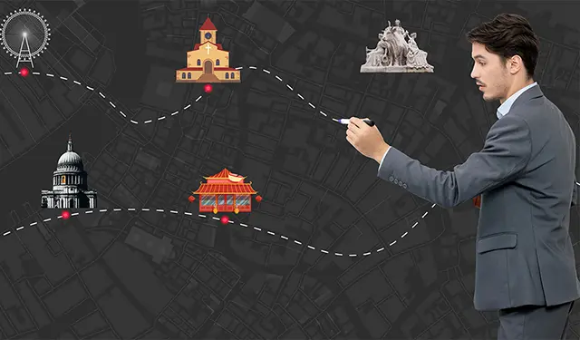
How it works: Download the app "GPSmyCity: Walks in 1K+ Cities" from Apple App Store or Google Play Store to your mobile phone or tablet. The app turns your mobile device into a personal tour guide and its built-in GPS navigation functions guide you from one tour stop to next. The app works offline, so no data plan is needed when traveling abroad.
Mount Washington Walking Tour Map
Guide Name: Mount Washington Walking Tour
Guide Location: USA » Pittsburgh (See other walking tours in Pittsburgh)
Guide Type: Self-guided Walking Tour (Sightseeing)
# of Attractions: 3
Tour Duration: 1 Hour(s)
Travel Distance: 1.8 Km or 1.1 Miles
Author: leticia
Sight(s) Featured in This Guide:
Guide Location: USA » Pittsburgh (See other walking tours in Pittsburgh)
Guide Type: Self-guided Walking Tour (Sightseeing)
# of Attractions: 3
Tour Duration: 1 Hour(s)
Travel Distance: 1.8 Km or 1.1 Miles
Author: leticia
Sight(s) Featured in This Guide:
- Duquesne Incline (Upper Station)
- Point of View Park
- Monongahela Incline (Upper Station)
1) Duquesne Incline (Upper Station) (must see)
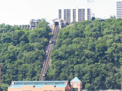
The Duquesne Incline is a type of railway system located close to the South Side neighborhood of Pittsburgh. It runs up Mount Washington in the city.
Initially powered by steam upon its completion in 1877, the purpose of the Duquesne Incline was to transport goods up and down Mount Washington during the late 19th century. Over time, it began to transport passengers, particularly residents of Mount Washington who found walking up the steep footpaths to be tiresome. Similar inclines were constructed across Mount Washington during this period. However, as more roads were built on the hill, most of these other inclines were shut down. By the late 1960s, only the Monongahela Incline and the Duquesne Incline remained operational.
In 1962, the Duquesne Incline was shut down, seemingly for good. It required significant repairs, but with few passengers, the private owners of the incline took little action. However, residents of Duquesne Heights initiated a fundraising campaign to support the incline's restoration. The campaign was highly successful, and on July 1, 1963, the incline reopened under the management of a non-profit organization committed to its preservation.
Since then, the Duquesne Incline has undergone extensive refurbishment. The cars have been restored to reveal their original wooden design after removing layers of paint. Additionally, an observation deck was constructed at the top, providing visitors with a panoramic view of Pittsburgh's "Golden Triangle." Today, the Duquesne Incline is one of the most popular tourist attractions in the city.
2) Point of View Park
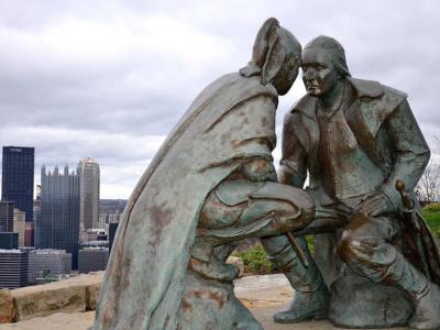
Point of View Park is a prominent landmark situated on Mount Washington's edge, at the westernmost point of Grand View Scenic Byway Park, within the designated Pennsylvania scenic byway. This unique park offers visitors not just a panoramic view of Pittsburgh but also serves as a cultural and historical emblem through its eponymous bronze sculpture, "Point of View."
The sculpture, which has given the park its name, was dedicated in 2006 and stands as a significant piece of public art. It artfully depicts a historic meeting between George Washington and the Seneca leader Guyasuta. The two figures are shown with their weapons down, engaging in a face-to-face dialogue in October 1770, a moment captured during Washington's exploration of land along the Ohio River for future settlement. This encounter highlights a pivotal moment of dialogue and mutual respect between two leaders from different cultures at a formative time in American history.
Prior to its official dedication in October 2006, locals affectionately referred to the site as "Photography Park." This nickname stemmed from its popularity among tourists and photographers alike, who were drawn to its concrete overlook for the purpose of capturing the stunning cityscape below. The park's transformation from a favored photography spot to a historical landmark encapsulates its dual appeal as both a scenic viewpoint and a commemorative space, reflecting the rich tapestry of Pittsburgh's past and present.
3) Monongahela Incline (Upper Station) (must see)
Constructed in 1870, the Monongahela Incline stands as the oldest continuously operating funicular in the United States. Alongside its counterpart, the Duquesne Incline, it represents one of only two surviving inclines from the original 17 passenger-carrying inclines established in Pittsburgh during the late 19th century.
The rapid expansion of Pittsburgh's industrial sector in 1860 spurred a significant influx of labor, primarily from German immigrants. This surge in population led to a pressing housing shortage, as industry claimed much of the flat terrain near the river, leaving only the steep hillsides of Mount Washington, also known as "Coal Hill," available for residential development. However, accessibility between the hill and other areas was limited by inadequate roads and public transportation.
Drawing on memories of cable cars from their native land, the predominantly German immigrant community residing on Mount Washington proposed the construction of inclines along the face of Coal Hill. This initiative materialized into the Monongahela Incline, which commenced operations on May 28, 1870.
Today, the Port Authority of Allegheny County oversees the operation of the Monongahela Incline, along with Pittsburgh's transit system, primarily for tourism purposes. Serving as a popular attraction, the incline transports visitors to the summit of Mount Washington, offering breathtaking vistas of downtown Pittsburgh and its surroundings.
Walking Tours in Pittsburgh, Pennsylvania
Create Your Own Walk in Pittsburgh
Creating your own self-guided walk in Pittsburgh is easy and fun. Choose the city attractions that you want to see and a walk route map will be created just for you. You can even set your hotel as the start point of the walk.
Downtown Architectural Jewels
Pittsburgh's Downtown is laden with an array of stylish architectural gems. Scattered throughout the city's urban core, these landmarks, some of which date back as far as the 18th century, collectively evoke an air of grandeur and historical significance.
The Fort Pitt Blockhouse, an emblem of resilience and frontier spirit, is the oldest extant structure in Western Pennsylvania,... view more
Tour Duration: 2 Hour(s)
Travel Distance: 2.6 Km or 1.6 Miles
The Fort Pitt Blockhouse, an emblem of resilience and frontier spirit, is the oldest extant structure in Western Pennsylvania,... view more
Tour Duration: 2 Hour(s)
Travel Distance: 2.6 Km or 1.6 Miles
Oakland District Walking Tour
Welcome to Oakland, an academic and cultural center of Pittsburgh! Representing a harmonious blend of intellectual prowess, cultural marvels, and natural splendor, this captivating neighborhood brims with attractions to overlook which would be a terrible miss!
As a manifestation of the transformative power of knowledge and creativity, Oakland, in large part, owes its status to the 19th-century... view more
Tour Duration: 2 Hour(s)
Travel Distance: 2.8 Km or 1.7 Miles
As a manifestation of the transformative power of knowledge and creativity, Oakland, in large part, owes its status to the 19th-century... view more
Tour Duration: 2 Hour(s)
Travel Distance: 2.8 Km or 1.7 Miles
Pittsburgh Introduction Walking Tour
Pittsburgh is the second largest city in Pennsylvania. The metro area is also the largest in Appalachia, the Ohio Valley and one of the most populous in the country. It known colloquially as "Steel City" due to its mainstay as a leader in manufacturing steel and other important materials like glass and aluminum. Pittsburgh also holds an important place in the history of the United... view more
Tour Duration: 2 Hour(s)
Travel Distance: 3.2 Km or 2 Miles
Tour Duration: 2 Hour(s)
Travel Distance: 3.2 Km or 2 Miles
Pittsburgh's Historical Churches
Pittsburgh's storied landscape is interwoven with the resplendent charm of its historical churches. Apart from being testaments to the city's rich religious heritage and the enduring spirit of faith, these abodes of worship stand as venerable monuments, whose architectural splendor etched an indelible mark on Pittsburgh.
Foremost among them is the First Presbyterian Church. This... view more
Tour Duration: 1 Hour(s)
Travel Distance: 1.4 Km or 0.9 Miles
Foremost among them is the First Presbyterian Church. This... view more
Tour Duration: 1 Hour(s)
Travel Distance: 1.4 Km or 0.9 Miles
The Most Popular Cities
/ view all
