Sutton Harbour, Plymouth
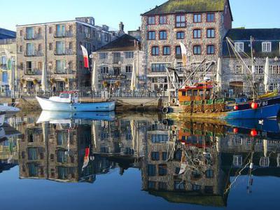
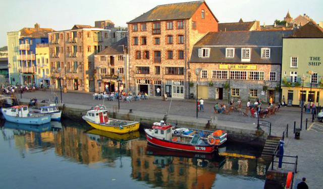
Previously known as "Sutton's Pool," Sutton Harbour is the original port of Plymouth. The port has expanded, but the old Harbour remains a busy fishing port and marina. It is part of the Barbican district of town and was the departure point of the Mayflower, carrying passengers and cargo to the New World.
Plymouth was settled as early as 700 AD. Sutton (southern settlement) was the original name for the town, taken from the Domesday Book (a comprehensive record of land in England, made in 1086 by order of William I). Sutton Harbour was the base of the English fleet that challenged the Spanish Armada. The Navy moved to Devonport, but fishing vessels and coastal carriers remained.
The Barbican borders the north and west ends of the harbor. It is named for the 15th-century fortification that formerly guarded the mouth of the Harbour. The district boasts of having the most cobbled streets in England. Over a hundred buildings date from the 16th and 17th centuries.
The Mayflower Steps, where the Pilgrims took ship for America in 1620, are marked by a porticoed platform on the West Pier of Sutton Harbour. Also on the West Pier is the Leviathan, a sculpture of an imaginary sea monster by artist and sculptor Brian Fell. It is 33 feet tall. Locals call it the Prawn.
The National Marine Aquarium of Plymouth, the largest in the UK, is located in the Barbican near the Royal Citadel. It has over 400 marine species.
Sutton Harbour is also a vibrant waterfront with a selection of luxury waterside properties, modern offices, a diverse range of restaurants, cafes, bars, shops, and year-round visitor attractions.
Want to visit this sight? Check out these Self-Guided Walking Tours in Plymouth. Alternatively, you can download the mobile app "GPSmyCity: Walks in 1K+ Cities" from Apple App Store or Google Play Store. The app turns your mobile device to a personal tour guide and it works offline, so no data plan is needed when traveling abroad.
Sutton Harbour on Map
Sight Name: Sutton Harbour
Sight Location: Plymouth, England (See walking tours in Plymouth)
Sight Type: Attraction/Landmark
Guide(s) Containing This Sight:
Sight Location: Plymouth, England (See walking tours in Plymouth)
Sight Type: Attraction/Landmark
Guide(s) Containing This Sight:
Walking Tours in Plymouth, England
Create Your Own Walk in Plymouth
Creating your own self-guided walk in Plymouth is easy and fun. Choose the city attractions that you want to see and a walk route map will be created just for you. You can even set your hotel as the start point of the walk.
Plymouth Introduction Walking Tour
Plymouth's early history began in the Bronze Age when the first settlement emerged at Mount Batten. It is mentioned in Ptolemy's Geographia as a maritime outpost exporting bronze mirrors.
The settlement was a major port in the southwest of England in Roman times. It was surpassed as a port in the ninth century by the nearby wealthier village of Sutton, later called Plymouth.
... view more
Tour Duration: 1 Hour(s)
Travel Distance: 1.9 Km or 1.2 Miles
The settlement was a major port in the southwest of England in Roman times. It was surpassed as a port in the ninth century by the nearby wealthier village of Sutton, later called Plymouth.
... view more
Tour Duration: 1 Hour(s)
Travel Distance: 1.9 Km or 1.2 Miles
Pilgrim Fathers Trail
Back in the early 17th century, a group of English Puritans – nowadays reverently referred to as the Pilgrim Fathers – fled religious persecution in their homeland and established a colony in North America that later became known as Plymouth, Massachusetts. The Pilgrims embarked on their perilous journey across the Atlantic from Plymouth, England in 1620 aboard a ship called the Mayflower,... view more
Tour Duration: 1 Hour(s)
Travel Distance: 0.5 Km or 0.3 Miles
Tour Duration: 1 Hour(s)
Travel Distance: 0.5 Km or 0.3 Miles
Plymouth Hoe Walking Tour
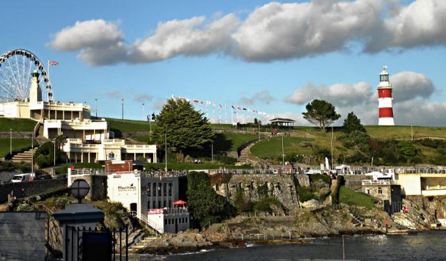
Plymouth Hoe, referred to locally as the Hoe, is a large south-facing open public space in Plymouth with commanding views of Plymouth Sound, Drake's Island, and further afield into Cornwall. The name derives from the Anglo-Saxon word hoh, which means a sloping ridge shaped like an inverted foot and heel.
This part of town has always been a meeting place, where people would come regularly... view more
Tour Duration: 1 Hour(s)
Travel Distance: 0.7 Km or 0.4 Miles
This part of town has always been a meeting place, where people would come regularly... view more
Tour Duration: 1 Hour(s)
Travel Distance: 0.7 Km or 0.4 Miles


