O'Briens Bridge, Galway
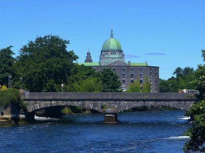
Until the Salmon Weir bridge was built in 1819, the way to cross the Corrib River in Galway was via the Old West Bridge, built in 1342. The Corrib is a short but lively current that passes through Galway to Galway Bay. This bridge was the one way to cross into the car-Connaught suburb of Galway.
In 1558 a gate and tower were built on the west end and a second gate and tower in the middle. In 1852 the old West Bridge was taken down. Strong walls were built on either side of the river and O'Brien's Bridge was built in its place. It has two main arches spanning the river channel. Patrick Nugent was the bridge contractor.
In 1889 the bridge was named in honor of William Smith O'Brien, a deceased MP once a leader of the Young Irelanders, a revolutionary group. The bridge is a vital link between the north and south sides of Galway. Going "west" is an expression long used by Galwegians for their adventures in the wild old West End of the city.
Want to visit this sight? Check out these Self-Guided Walking Tours in Galway. Alternatively, you can download the mobile app "GPSmyCity: Walks in 1K+ Cities" from Apple App Store or Google Play Store. The app turns your mobile device to a personal tour guide and it works offline, so no data plan is needed when traveling abroad.
O'Briens Bridge on Map
Sight Name: O'Briens Bridge
Sight Location: Galway, Ireland (See walking tours in Galway)
Sight Type: Attraction/Landmark
Guide(s) Containing This Sight:
Sight Location: Galway, Ireland (See walking tours in Galway)
Sight Type: Attraction/Landmark
Guide(s) Containing This Sight:
Walking Tours in Galway, Ireland
Create Your Own Walk in Galway
Creating your own self-guided walk in Galway is easy and fun. Choose the city attractions that you want to see and a walk route map will be created just for you. You can even set your hotel as the start point of the walk.
Galway Introduction Walking Tour
Galway is located on the River Corrib between Lough Corrib and Galway Bay. It was in the old Kingdom of Connacht. Galway grew from a settlement around a fortification established by the King of Connacht in 1124.
In 1484 a Charter of Mayoralty was granted to the first mayor of Galway, Peirce Lynch, by Richard III of England. Lynch was one of the "Tribes of Galway" that ruled the town... view more
Tour Duration: 2 Hour(s)
Travel Distance: 2.6 Km or 1.6 Miles
In 1484 a Charter of Mayoralty was granted to the first mayor of Galway, Peirce Lynch, by Richard III of England. Lynch was one of the "Tribes of Galway" that ruled the town... view more
Tour Duration: 2 Hour(s)
Travel Distance: 2.6 Km or 1.6 Miles
Salthill Seaside Walking Tour
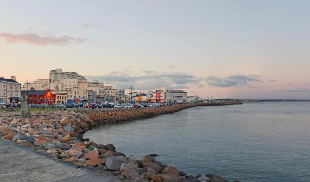
If you fancy a quality break by the sea, while in Galway, you don't need to go far. The small seaside spot called Salthill is only 3km away from the downtown shops, clubs and pubs, and you can get here on foot easily.
Speaking of pubs, there's no shortage of them in Salthill either. In fact, one of the local waterholes – O'Connors – bills itself as the first singing pub in... view more
Tour Duration: 1 Hour(s)
Travel Distance: 1.4 Km or 0.9 Miles
Speaking of pubs, there's no shortage of them in Salthill either. In fact, one of the local waterholes – O'Connors – bills itself as the first singing pub in... view more
Tour Duration: 1 Hour(s)
Travel Distance: 1.4 Km or 0.9 Miles


