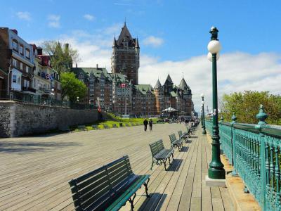
Dufferin Terrace (Terrasse Dufferin), Quebec City (must see)
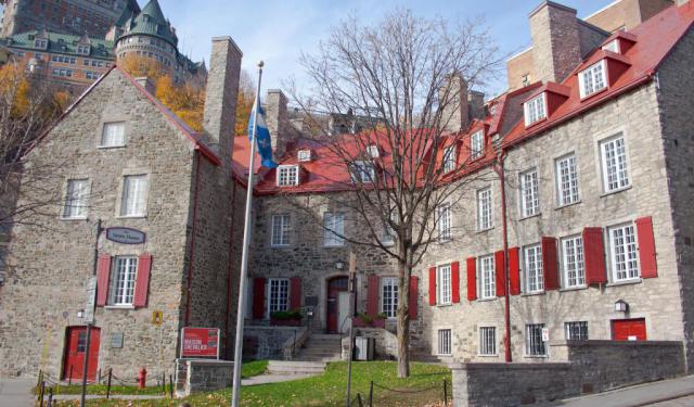
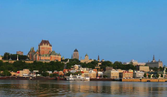
The Dufferin Terrace (Terrasse Dufferin) is a wide, wooden boardwalk wrapping around the front of the Frontenac Castle (Château Frontenac) towards the Citadel of Quebec. The abundance of gazebos and benches here, not to mention the panoramic views of the Saint Lawrence River, the South Shore, and Orleans Island (Île d'Orléans), makes this place an equally loved leisure spot by both locals and tourists.
Remarkably, the use of wooden planks gives this whole thing an “air of summer”, even in the middle of winter when the famous Terrasse Dufferin Slides, a huge (150-metre/490-foot) toboggan on the south end of the terrace, is open during the Quebec Winter Carnival (Carnaval de Québec), from late January to mid-February.
The promenade was built in 1838 and was first known as Durham Terrace. It was enlarged in 1854 and then remodeled, in 1878-1879, under the direction of the then Governor General of Canada, Marquess of Dufferin, whose name it now bears. Each of the six gazebos found on this boardwalk has a name – going north-south, it is Frontenac, Lorne, Princess Louise, Victoria, Dufferin, and Plessis.
Underneath the terrace is the archaeological site of Saint Louis Fort and Castle (Château Saint-Louis), featuring the remains of the former seat of power occupied by the French and British governors of the territory from 1620 to 1834 (when it was destroyed by fire) – it is now open for viewing through the three specially built-in peek-a-boo windows.
Also, at the southern end of the terrace is the entry to the Governors' Promenade, a walkway to the Plains of Abraham built into the cliffs below the Citadel. Nearby, a few old guns recall the strategic position of the place once guarded by artillery batteries.
Want to visit this sight? Check out these Self-Guided Walking Tours in Quebec City. Alternatively, you can download the mobile app "GPSmyCity: Walks in 1K+ Cities" from Apple App Store or Google Play Store. The app turns your mobile device to a personal tour guide and it works offline, so no data plan is needed when traveling abroad.
Dufferin Terrace (Terrasse Dufferin) on Map
Sight Name: Dufferin Terrace (Terrasse Dufferin)
Sight Location: Quebec City, Canada (See walking tours in Quebec City)
Sight Type: Attraction/Landmark
Guide(s) Containing This Sight:
Sight Location: Quebec City, Canada (See walking tours in Quebec City)
Sight Type: Attraction/Landmark
Guide(s) Containing This Sight:
Walking Tours in Quebec City, Quebec
Create Your Own Walk in Quebec City
Creating your own self-guided walk in Quebec City is easy and fun. Choose the city attractions that you want to see and a walk route map will be created just for you. You can even set your hotel as the start point of the walk.
Historical Houses Walking Tour
Quebec City, particularly evocative of Europe in its atmosphere, is often referred to as the cradle of New France. The city boasts one of the richest architectural heritages in North America, though most of its buildings had to be adapted to harsh winters and the lack of specialized workers and materials in the colony. As such, the majority of local houses were designed as simple and efficient... view more
Tour Duration: 2 Hour(s)
Travel Distance: 2.5 Km or 1.6 Miles
Tour Duration: 2 Hour(s)
Travel Distance: 2.5 Km or 1.6 Miles
Quebec City Introduction Walking Tour
Cresting a cliff above the St. Lawrence River, Québec City (French: Ville de Québec) is the soul of the province of Québec – a place all its own; a country within a country with its own traditions, architecture, and French-speaking population.
The Algonquian people had originally named the area Kébec, which means "where the river narrows", because the Saint Lawrence River... view more
Tour Duration: 2 Hour(s)
Travel Distance: 3.2 Km or 2 Miles
The Algonquian people had originally named the area Kébec, which means "where the river narrows", because the Saint Lawrence River... view more
Tour Duration: 2 Hour(s)
Travel Distance: 3.2 Km or 2 Miles
Old Quebec Walk
The historic part of Quebec City known as Old Quebec (French: Vieux-Québec), sometimes also referred to as the Latin Quarter (Quartier Latin), is the neighborhood centered around Cape Diamond (Cap Diamant), located on the eastern edge of Quebec hill promontory. The area comprises Upper Town (Haute-Ville) and Lower Town (Basse-Ville) and is currently listed among UNESCO’s World Heritage Sites.
... view more
Tour Duration: 2 Hour(s)
Travel Distance: 2.6 Km or 1.6 Miles
... view more
Tour Duration: 2 Hour(s)
Travel Distance: 2.6 Km or 1.6 Miles
Qucbec City's Historical Churches Walking Tour
The first religious buildings in Canada were established by the Récollets and Jesuits, in 1615 and 1625, respectively, when they first arrived in New France. Later on, the French colonists brought along their culture and architectural traditions, and the establishment of British and evangelical society triggered further major developments in Quebec City.
Over the course of the 17th and 18th... view more
Tour Duration: 2 Hour(s)
Travel Distance: 2.9 Km or 1.8 Miles
Over the course of the 17th and 18th... view more
Tour Duration: 2 Hour(s)
Travel Distance: 2.9 Km or 1.8 Miles

